It all started with a line on a map. A line that was described in the scantest of details. But there it was, tempting me to find out what lay along its path.
It turns out that pure unvarnished nature awaited me, with all the glory and gruelling realities of being alone on a trail designed to test the physical and mental limits of the monks that have graced its peaks for centuries.
In order to complete it, I’d have to be entirely self-sufficient for 7 days at alpine elevations where there was no easy way to quit halfway through.
In this series of posts, I’ll look at the cultural significance of the trail, my day-by-day experiences, and some practical advice if you want to walk it yourself.
Contents
- Trail Overview (this article)
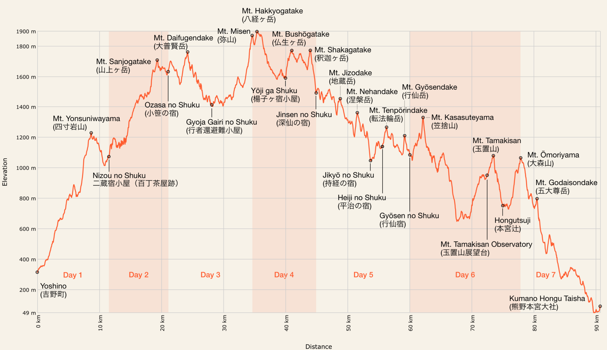
- Day 1 – Yoshino to Nizou no Shuku
- Day 2 – Nizou no Shuku to Ozasa no Shuku
- Day 3 – Ozasa no Shuku to Misen
- Day 4 – Misen to Jinsen no Shuku
- Day 5 – Jinsen no Shuku to Gyōsen no Shuku
- Day 6 – Gyōsen no Shuku to Mt. Ōmoriyama
- Day 7 – Mt. Ōmoriyama Peak to Kumano Hongū Taisha
- Long-Distance Hiking Gear Guide
Background
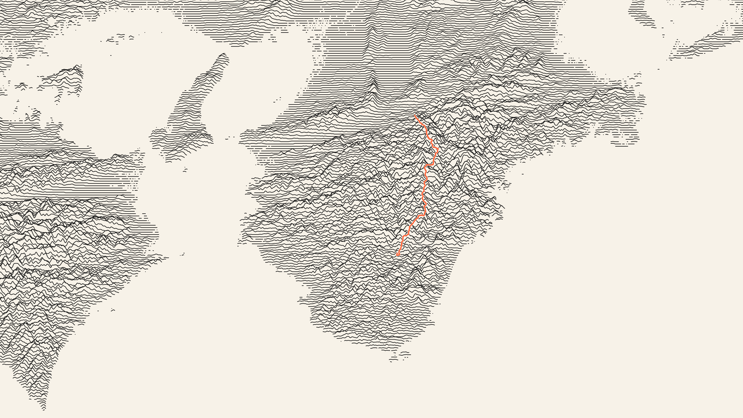
The Kumano Kodō (熊野古道) is a network of ancient trails which crisscross the mountainous Kii Peninsula (east of Shikoku on the Honshu mainland) that have been walked by pilgrims since the 10th century.
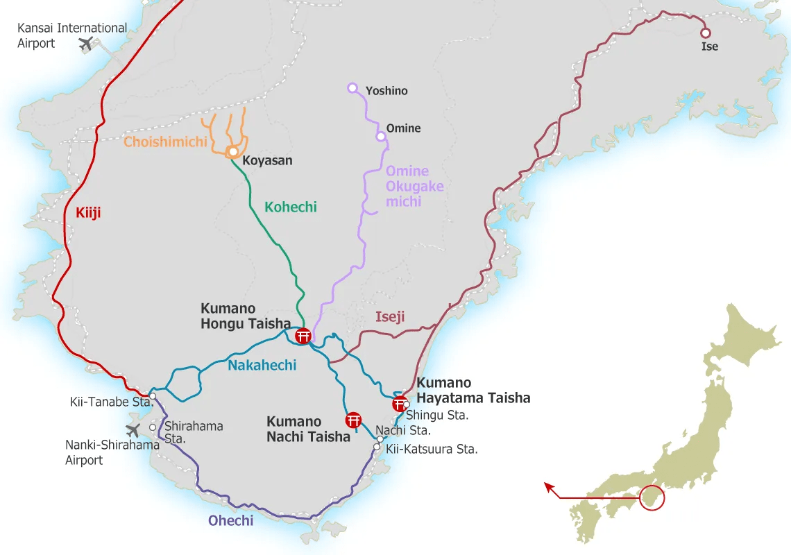
The trails are used to visit the Kumano Sanzan (熊野三山) or the Three Grand Shrines of Kumano: Kumano Hongū Taisha (熊野本宮大社), Kumano Nachi Taisha (熊野那智大社) and Kumano Hayatama Taisha (熊野速玉大社).
In prior years I’d already walked the central Kohechi and coastal Ise-ji routes but was intrigued by the mysterious Omine-okugake Michi (大峰奥駈道) trail which is shown on some maps but has been rarely written about in English. Given much of it lies deep in uninhabited mountains it’s easy to guess why.
History
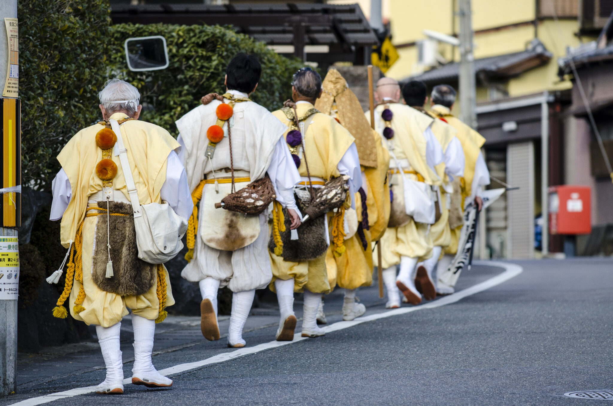
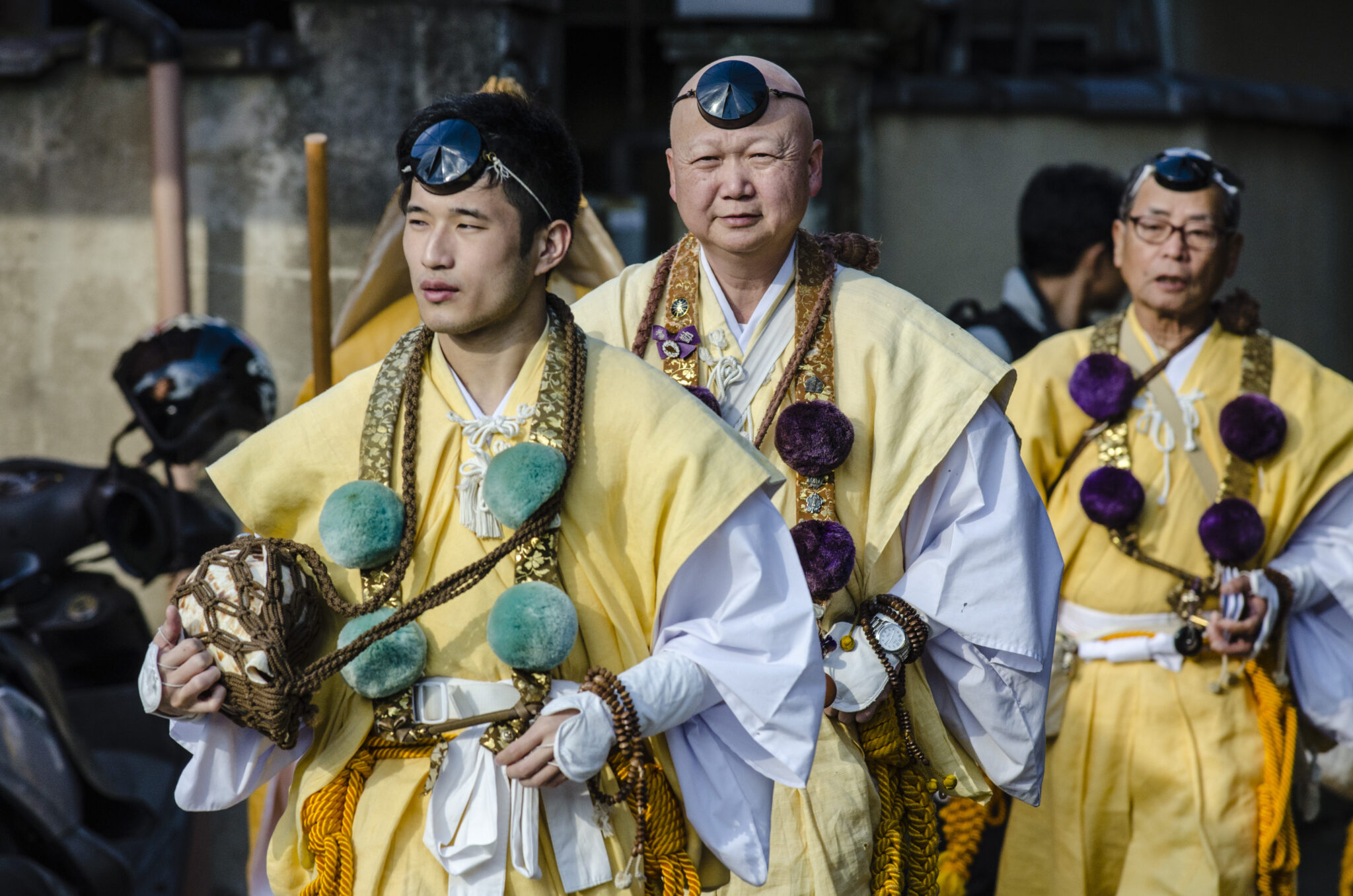
According to legend, the 100 km Omine-okugake Michi path was pioneered by En no Gyōja (役小角), the founder of Shugendō (修験道). Shugendō, literally meaning “the path of training and testing”, is an indigenous Japanese religion whose origins lie in mountain worship and was founded in the Hakuhō period (7th century).
The path connects the two holy areas of Yoshino (吉野町) and Kumano (熊野地方) and is said to be the most difficult ascetic training route for Shugendō practitioners, known as Yamabushi (山伏), or mountain priests.
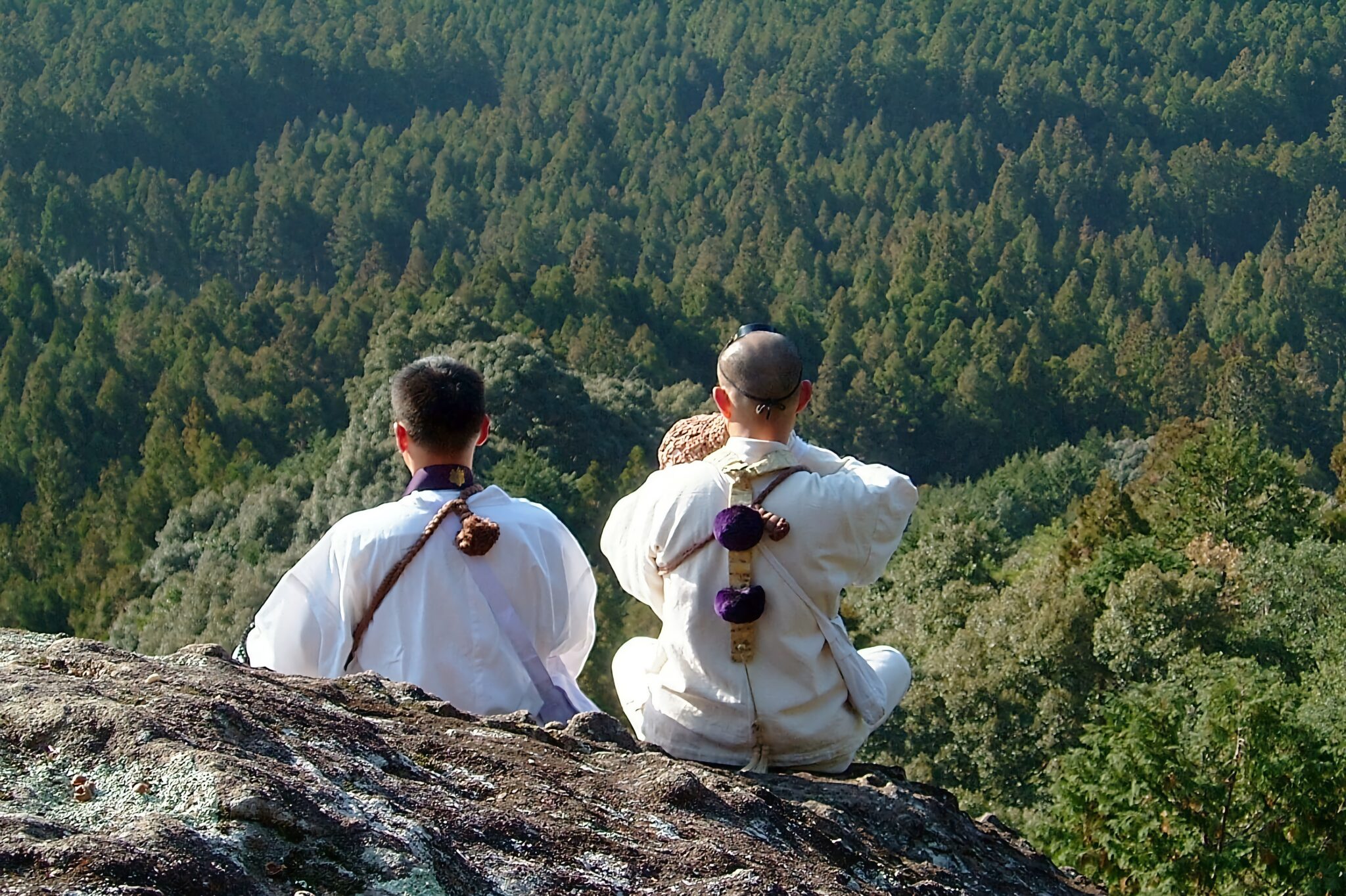
Religious shugyo practices sometimes involve dangerous feats, such as rock climbing without a rope, and traversing cliff faces where a fall would mean near-certain death.
It is said that during the Heian period (794-1192) there were 120 sacred sites and training places along the ridges of the Omine mountain range. Over time, these sites were reorganised and their number dwindled, eventually reaching 75 locations that are now collectively referred to as the 75 Omine Nabiki (靡). “Nabiki” is a Shugendō term that refers to plants bending in the wind through the power of En no Gyōja. As such these Nabiki are regarded as hallowed ground where Shugendō deities are said to appear.
Mount Sanjōgadake (山上ヶ岳), popularly known as Mount Ōmine (大峰山), is the largest sacred place for religious training in the Omine area and the headquarters of Shugendō. It is said that Zaō Gongen (蔵王権現), the main god worshipped in Shugendō, appeared in front of En no Gyōja as a result of his rigorous training.
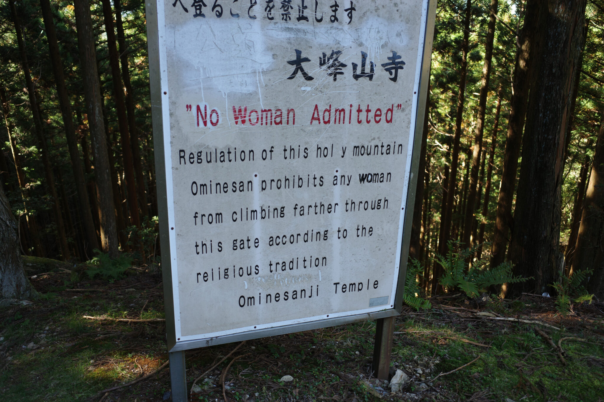
Mount Ōmine lays claim to a contentious 1,300-year legacy as a male-access-only sacred peak. Most territorial proscriptions dissolved in 1872 when the Meiji government granted women full access to mountain shrine and temple lands, but traces of gender-exclusive practices can still be found at some mountains in Japan, especially those controlled by powerful Buddhist temples. The ban has been challenged many times but without success.
On top of the mountain is Sanjozado hall, the main hall of Ōminesan-ji Temple (大峯山寺), whose origin dates back to the early Nara period (early 8th century). Although fires burned down the hall on multiple occasions, each time the hall was faithfully rebuilt. Reconstruction work on the present hall was completed in 1706. It is located at the highest altitude (1,719 m) of all of Japan’s officially designated Important Cultural Properties and was added to the list of UNESCO World Heritage sites in 2004.
Geography
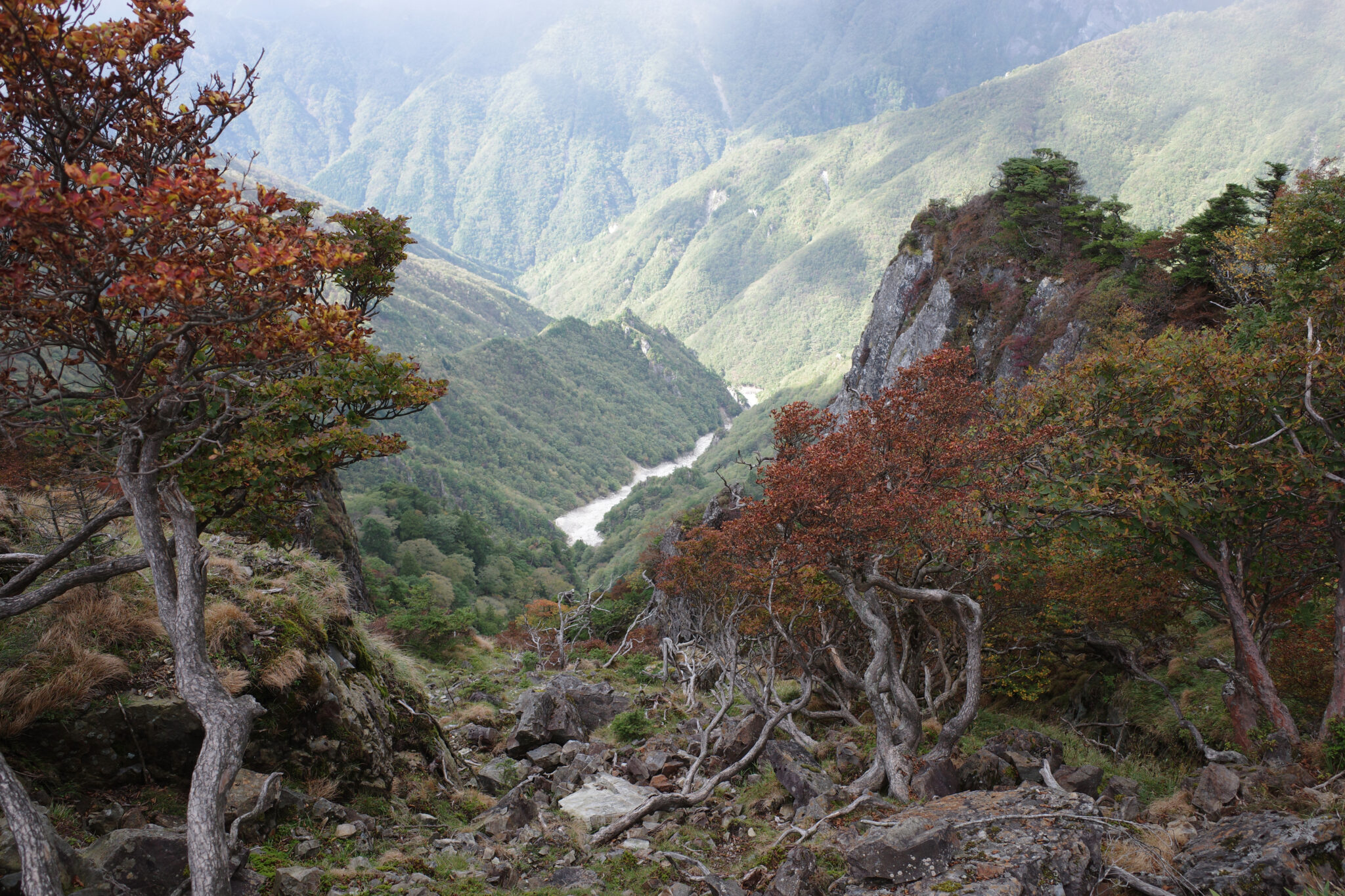
Lying at the heart of the Kii Peninsula (紀伊半島), the Omine mountain range consists of a series of peaks at elevations of 1,200 – 1,900 m, including Mt. Sanjōgatake (1,719 m), Mt. Misen (1,895 m), and Mt. Hakkyogatake (1,915 m), the tallest mountain in the Kansai region.
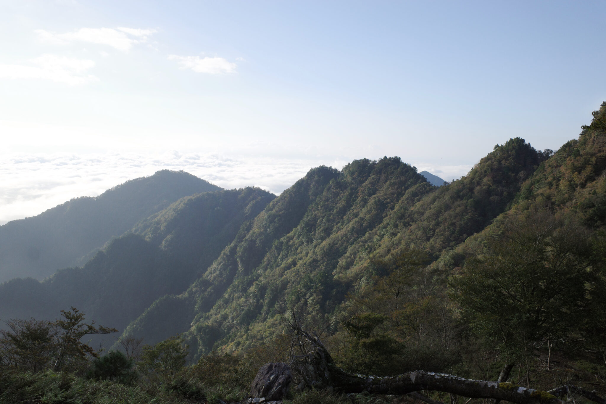
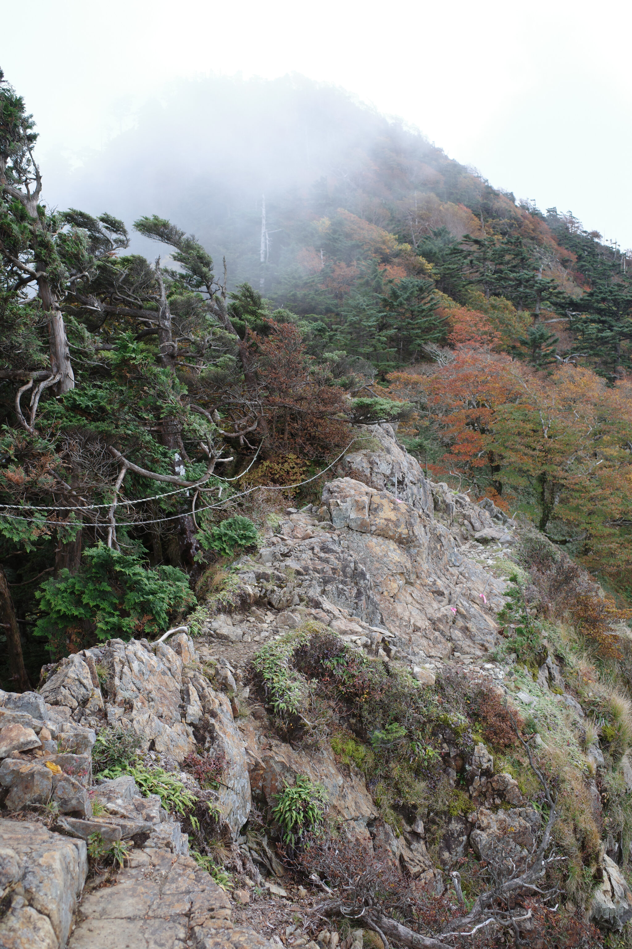
The Omine-okugake Michi follows a rugged sawtooth ridgeline most of the way, making it notorious for its backbreaking constant ups and downs.
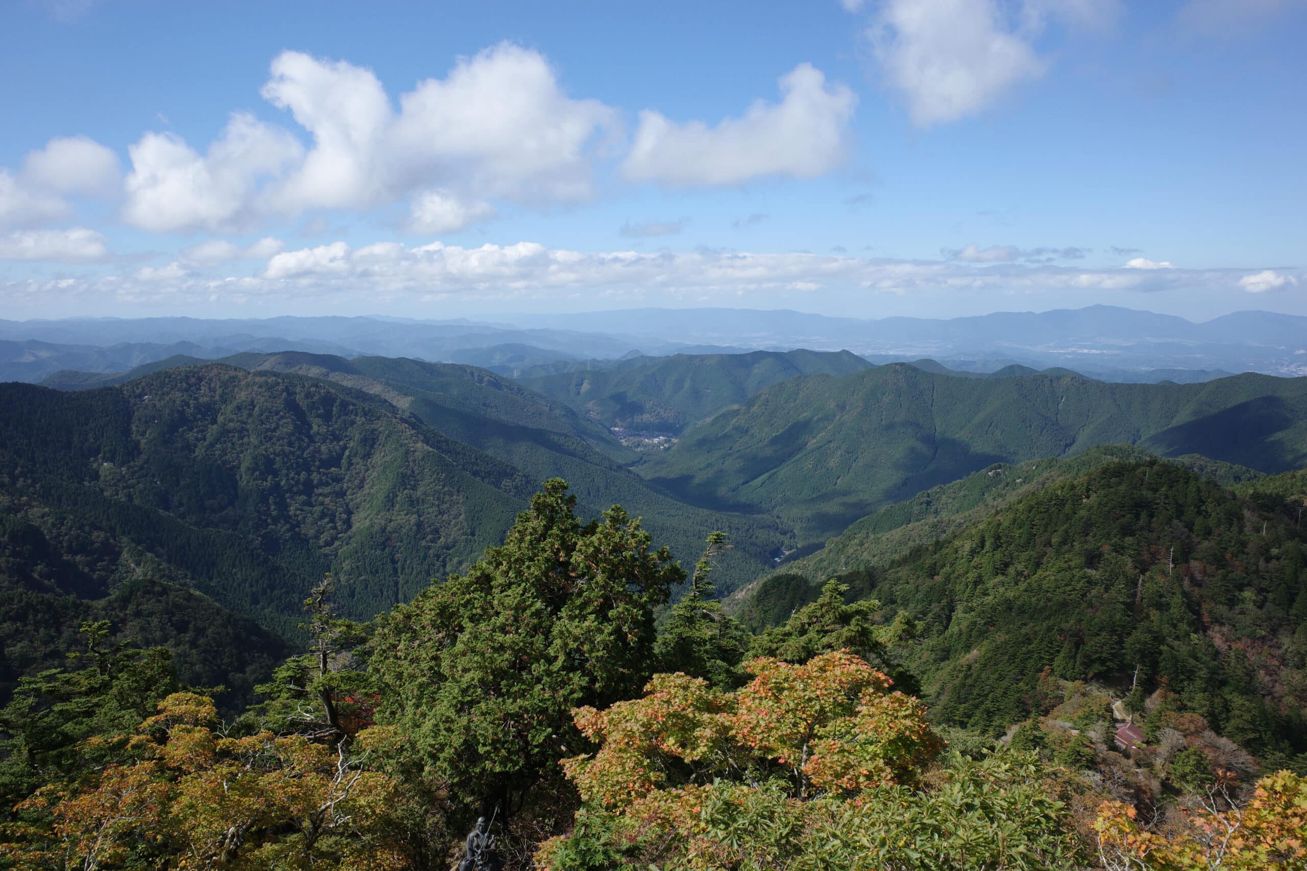
The dense forests on either side of the trail have been maintained and administered by Shugendō associations and local citizens, and the custom of not harvesting lumber from these areas continues to this day. As a result, the forests along the path remain intact and afford magnificent views of the surrounding mountains.
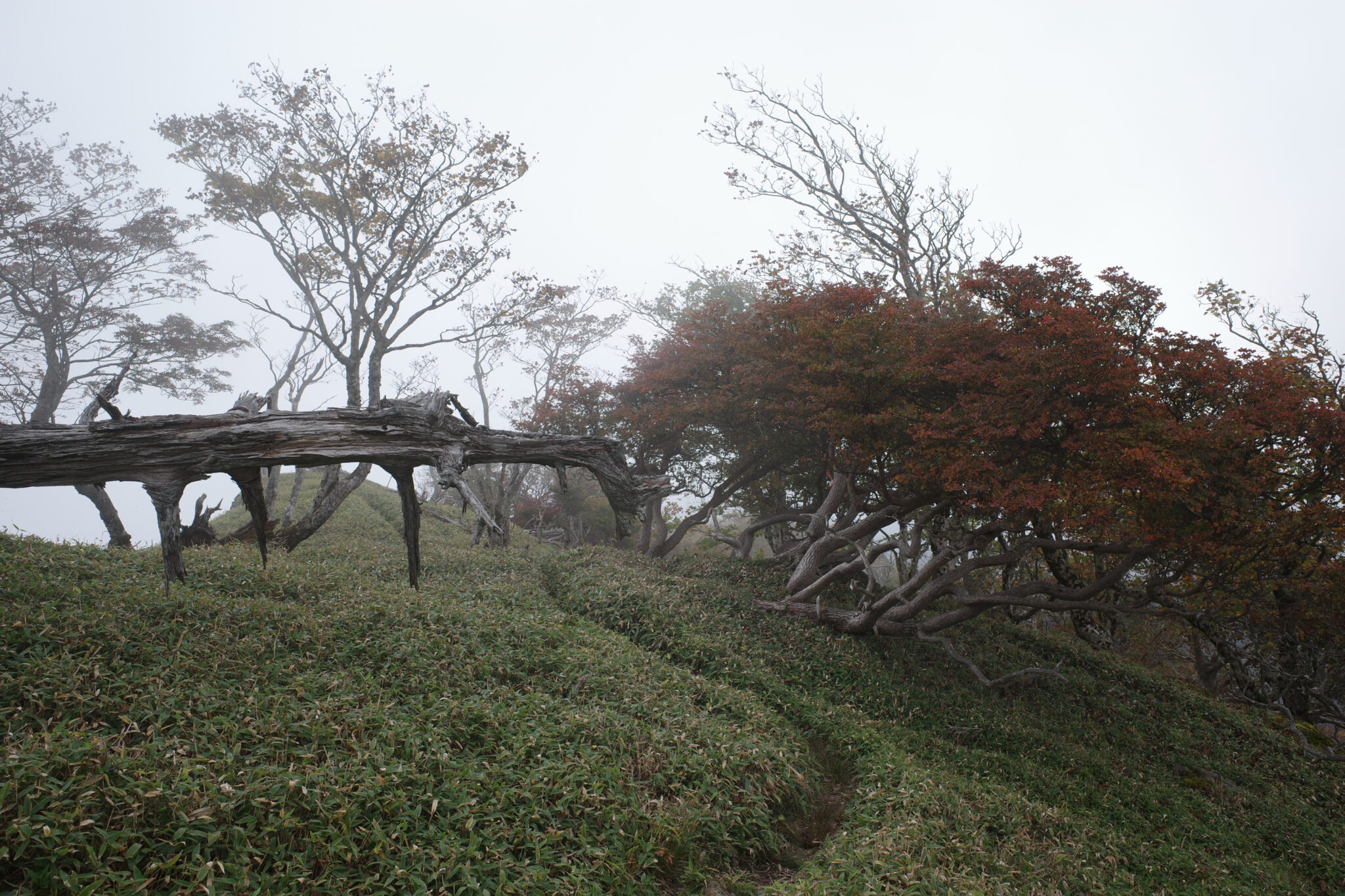
Along the route grow oyamarenge alpine shrubs (オオヤマレンゲ / magnolia sieboldii), that bloom white flowers similar to lotus plants. Also of note is the Bukkyogatake Primeval Forest (仏経嶽原始林) where silver fir trees (シラビソ / abies veitchii) grow along the sub-alpine ridges near the highest peaks of Omine.
The Omine mountain range lies in the Yoshino-Kumano National Park (吉野熊野国立公園) designated officially as a National Park in 1936.
Risks and challenges
The information provided in this guide is for reference only and some details may not be up-to-date. Please do your own research and take sensible precautions/preparations before undertaking your own adventure.
- Water – you will need to collect (and optionally filter) all your water as you go. The marked water holes/streams are not reliable year-round so you should aim to collect and carry as much as you can when available (2+ litres).
- Food – beyond Yoshino town there are no restaurants or shops so you will need to carry enough food for 7+ days. Don’t be tempted to eat the wild mushrooms!
- Weather – up in the mountains the weather can be unpredictable and change quickly. Be sure to bring rain gear and warm layers for the evenings/nights when the temperature rapidly drops.
- Shelter – there are unmanned mountain huts every 5-10 km that you can stay overnight in (for a small donation) but don’t count on them all being open or having space. It would be wise to bring a small tent or bivvy bag.
- Fitness – to complete the trail you will need to be able to walk 14 km+ (8-9 hours) and ascend 1000 m+ each day carrying 10 kg+ along a route that constantly undulates.
- Heights – Many parts of the route are exposed to large drops and some climbing of ladders and chains over steep rocks is required (no special equipment is needed).
- Animals – while a run-in with a bear is unlikely, you will probably encounter deer, wild boar, and snakes. Leave them alone and they will probably not trouble you.
- Communication – phone signal is unavailable most of the route. It would be wise to bring a satellite GPS device in case of emergency.
- Isolation – once you’ve started the hike there isn’t any easy way to bail out other than to turn back or complete it. There may be days when you see nobody at all.
- Being female – unfortunately, the area around Ōminesan-ji Temple is off limits to women due to religious traditions. A large detour is required to avoid it.
Warning: On Dec 14, 2022 a man was attacked by a bear and fell from a cliff on the trail near Mt. Daifugendake. According to the Nara Prefectural Government’s wildlife control section, as of November 19, there had been 65 bear sightings in the prefecture, far exceeding the 20 sightings last year and the 53 sightings two years ago.
When to go
The best time to walk is when it’s not too hot and there is no snow remaining. Thus spring (late April to mid-May) or autumn (October to early November) are optimal. Summer is too hot to walk with a heavy bag and sufficient water.
More people walk during spring when the water holes are less likely to dry up but conversely, it means the mountain huts can get crowded. From May to September, hikers will almost certainly run into Shugendō practitioners.
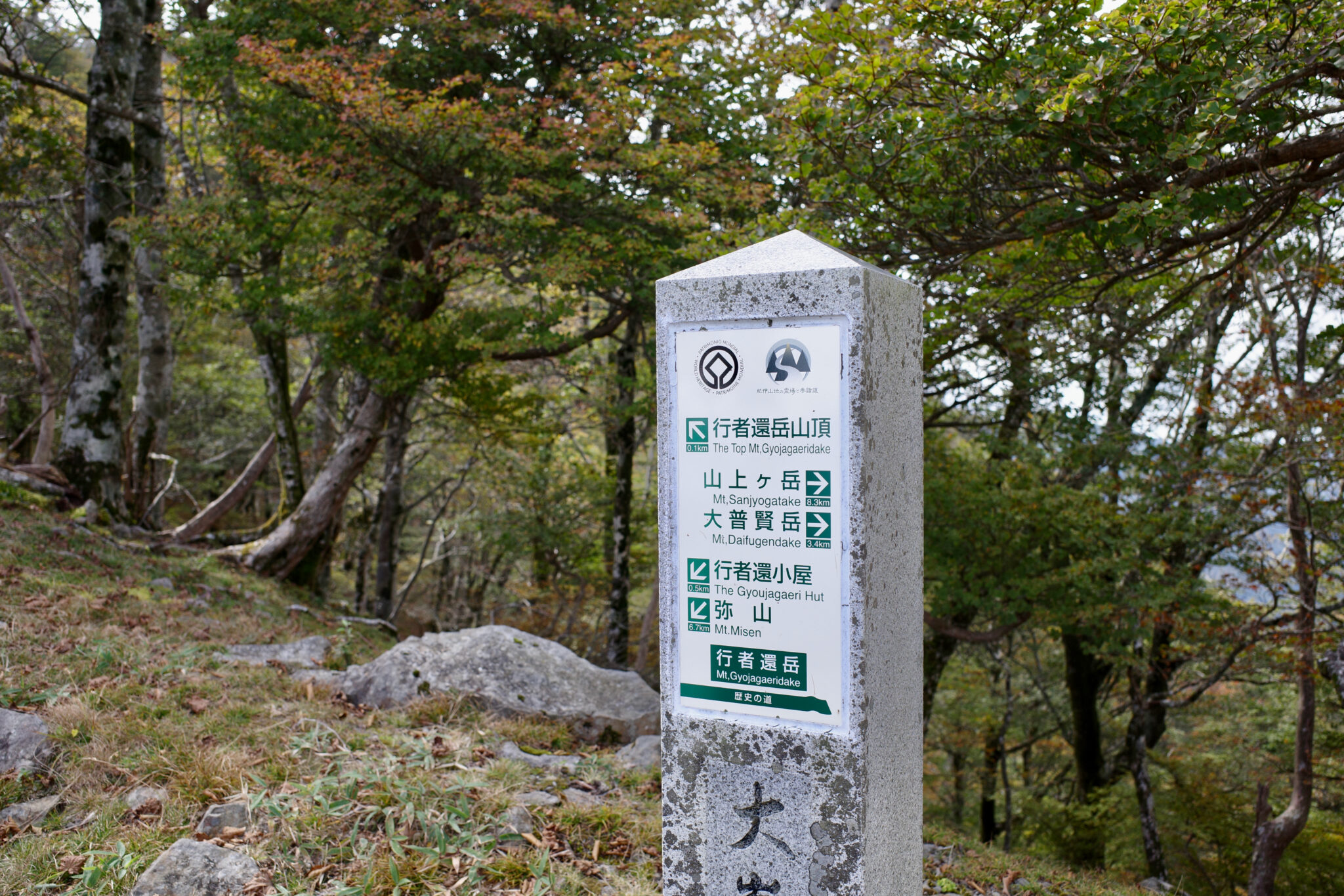
How to navigate
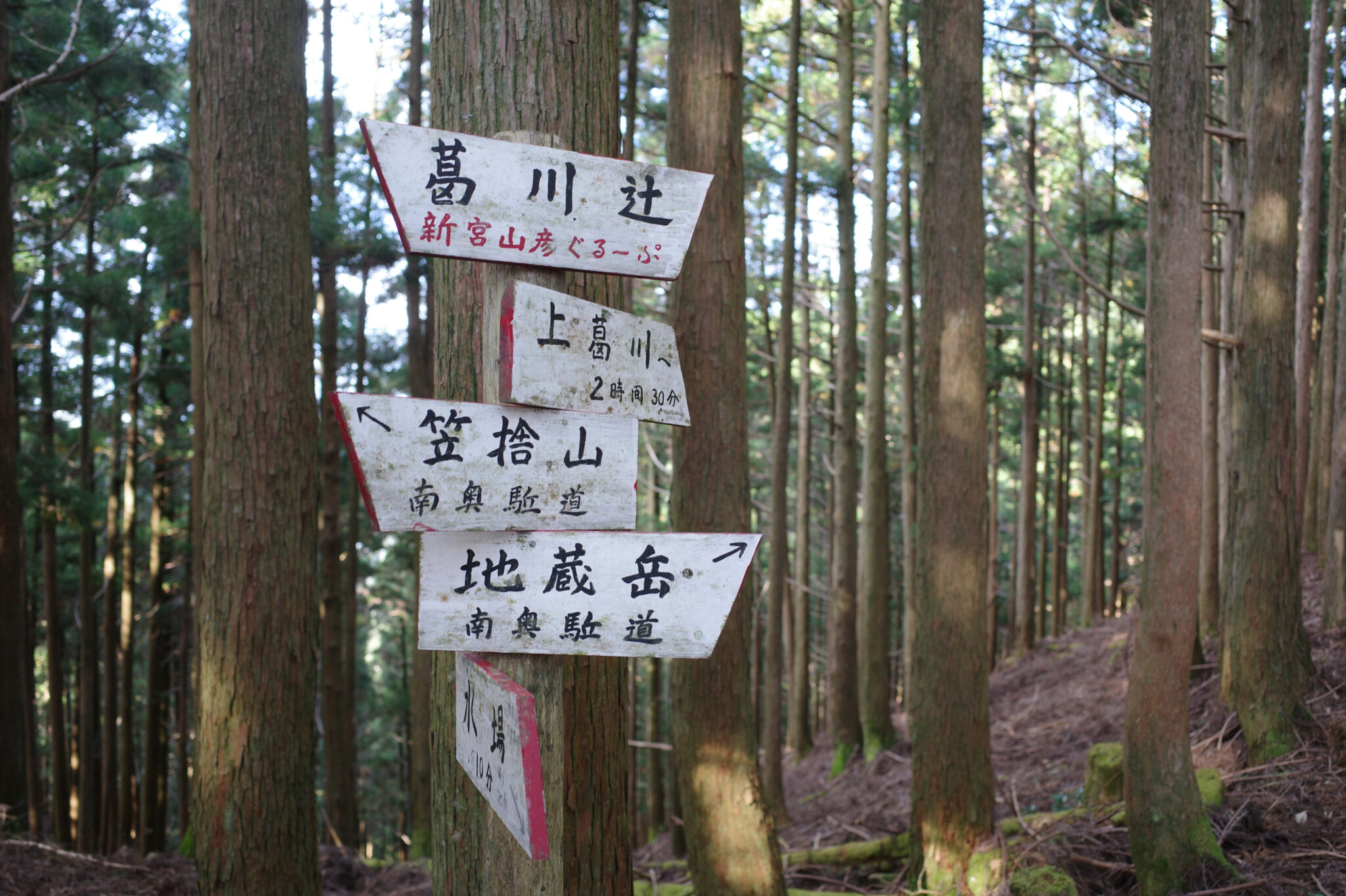
The trail is well-marked by coloured ribbons and signposts. While some show both Japanese and English, you’ll want to familiarise yourself with the Kanji characters for your next destination so you don’t take a wrong turn.
Although there is rarely any phone signal along the route, GPS can still be used with an app like Gaia GPS to navigate. I kept my iPhone in low power mode with the Wi-Fi/Bluetooth/data turned off and the screen brightness turned down to save battery life. You’ll need to carry a large power bank to recharge.
I’ve made the entire trail and all the key waypoints available on Gaia GPS. Even with this, be sure to bring the paper map as a backup and an additional reference.
Where to sleep
Below is a list of mountain huts (known as shuku or yamagoya in Japanese) as they appear if you walk north to south from Yoshino to Hongu. I’ve marked where I stayed to give you an idea of what’s possible.
| Name | Km from previous | ~Hrs from previous | Stayed | Notes |
|---|---|---|---|---|
| Yoshino (吉野町) | 0 | 0 | No | Start |
| Nizou no Shuku 二蔵宿小屋 (百丁茶屋跡) | 12.3 | 6.6 | Day 1 | Free, water 10 mins away (unreliable) |
| Ozasa no Shuku (小笹の宿) | 10.1 | 6.5 | Day 2 | Free, water available from a stream |
| Gyoja Gairi no Shuku (行者還避難小屋) | 6.9 | 4.5 | No | Free, water source (unreliable) |
| Misen (弥山小屋) | 6.5 | 3.5 | Day 3 | 500 yen to camp, 100 yen/litre for water |
| Yōji ga Shuku (楊子ヶ宿小屋) | 5.3 | 2.5 | No | Free, water 5 mins away (unreliable) |
| Jinsen no Shuku (深仙の宿) | 4.7 | 3 | Day 4 | Free, water 5 mins away (unreliable) |
| Jikyō no Shuku (持経の宿) | 8.8 | 5.5 | No | 2,000 yen |
| Heiji no Shuku (平治の宿) | 1.6 | 1 | No | 2,000 yen |
| Gyōsen no Shuku (行仙の宿) | 4.7 | 3 | Day 5 | 2,000 yen, water 30 mins away (unreliable) |
| Mt. Tamakisan Observatory (玉置山展望台) | 13.4 | 9 | No | Possible to camp, rain collection tank next to toilets |
| Hongutsuji (本宮辻) | 2.6 | 1 | No | Wild camp, no water nearby |
| Mt. Ōmoriyama (大森山) | 3.3 | 1.5 | Day 6 | Wild camp at peak, no water nearby |
| Kumano Hongū Taisha (熊野本宮大社) | 12.4 | 5.5 | Day 7 | Accommodation in Hongu, Yunomine Onsen, or Kawayu Onsen |
- Huts are first-come, first-served so you will need to camp outside if full
- Misen is the only manned hut along the route; you can buy water here for 100 yen/litre
- After Gyōsen no Shuku there are no more huts so you will need to camp the final night
- There are many spots to wild camp along the route, just remember to leave no trace
- The route can be hiked in either direction but Yoshino is easier to access by public transport
Diary
Day 1 → Day 2 → Day 3 → Day 4 → Day 5 → Day 6 → Day 7
Podcast
I was recently interviewed about the Omine Okugake by the Trails Around the World podcast!
With thanks to Masako Vierstraete and Tomoki Tsujita for their help in compiling this guide.
Reply