
Found this cool little data visualisation [via infosthetics] called dataCloud which “displays the live weather conditions of major cities across the globe simultaneously. The information is gathered from airports all over the world and updated several times a day.
It maps the weather conditions onto each city’s name. The type size relates to visibility, the color to temperature, the transparency to Humidity. They move with the speed and direction of their wind and their atmospheric pressure is applied as friction to the movement.”
People have submitted photos from all over the world which are displayed on the background. It’s a really neat idea which is mesmerising to watch but possibly limited in practical application. Check out the Artificial Tourism site for more info!
If like me you’re often left scratching your head trying to figure out what time it is in xyz country so that you know you’re not going to phone someone in the middle of the night or wondering why they are taking so long to reply to an email then help is at hand…
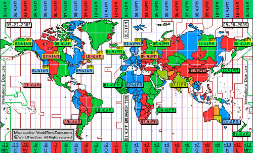
World Time Zone Map – Simple colourful map (see above), my favourite!
Time Ticker – Snazzy flash world map with selectable time regions
World Time Live – Basic but functional
World Clock – Textual customisable display of time offsets
So there you have it – no more excuses for calling friends/colleagues at 2am!
Reply